Kazimierz
Kazimierz was founded by King Casimir the Great in a charter of 1335, south of medieval Kraków, and much of its right-angled street grid is still there. Jews settled in the mid-14th century and, until the early 19th century, lived inside a district bounded by today’s Miodowa, św. Wawrzyńca, Wąska, Józefa and Bożego Ciała. Before the Second World War Kraków had over 64,000 Jewish residents, about a quarter of the city.
A town chartered in 1335
The city of Kraków’s note on the cultural park places Kazimierz south of the medieval city. King Casimir the Great founded it by an act of 1335. The spatial layout, a characteristic grid of streets meeting at right angles, survives in large part. The tight building fabric of this part of the district is from the 18th and 19th centuries. The urban pieces the city names are the central market, now Plac Wolnica, with a Renaissance town hall, and two monastic churches of the 14th and 15th centuries, Corpus Christi and St Catherine. A further landmark is the Pauline church and monastery on Skałka, built in the 18th century. Fortifications laid out in the 14th century were later absorbed into the buildings. Stradom, the suburb that grew between Kazimierz and Kraków, became the link between the two towns. The same note says Kazimierz and Stradom sit in the most historically valuable part of Kraków, shaped by being next to the then capital, and that Jewish material and immaterial heritage is a large part of what the two districts carry. A later city project evaluation, quoting the conservation stakes, states that the Kazimierz area is on the UNESCO World Heritage List and under strict conservation protection.
The Jewish town inside the town
The city’s page on Jewish Kazimierz says Jews appeared here in the mid-14th century and, until the early 19th century, lived in the “Jewish town”, closed inside today’s ul. Miodowa, ul. św. Wawrzyńca, ul. Wąska, ul. Józefa and ul. Bożego Ciała. It calls that ground an autonomous enclave. Jews governed themselves there. Above them was only the king, in whose name the voivode of Kraków held power. From the turn of the 19th and 20th centuries the Jewish population gradually occupied all of Kazimierz and the neighbouring district of Stradom. From the end of the 19th century Jews also took part in building the district, as investors, contractors and architects. Equal civic rights, granted in the 1860s, are what the city says made that economic and social activity possible, and made it easier for a Jewish intelligentsia to assimilate and to live outside Kazimierz.
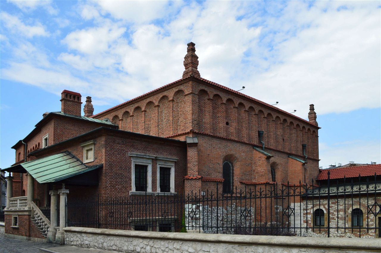
Before the Second World War the city counted over 64,000 Jews, a quarter of Kraków’s population. Up to 1939 they had built a social infrastructure, mostly on Kazimierz, which between the wars remained a strongly Jewish district and the social base of most Jewish organisations. The city lists political parties of every shade, educational, charitable, cultural, artistic and sporting bodies, and the religious life of Kraków’s Jews. They prayed in six large Orthodox synagogues, the Old, the Remuh, the High, the Isaac, the Popper and the Kupa, and in the progressive Tempel. The Jewish community maintained those seven. Many smaller prayer houses belonged to religious associations and to private people. A separate city walking route starts at the Jewish Cultural Centre on ul. Beera Meiselsa and then names the buildings with dates: Tempel on ul. Miodowa, built in 1862 for the Association of Progressive Israelites; the 17th-century Kupa on ul. Warszauera; Isaac on ul. Jakuba, built 1638–1644; the High Synagogue on ul. Józefa, raised in 1590. Szeroka is the peak of that route, with three prayer houses. The Old Synagogue is called the oldest Jewish building in Poland, from the 15th century, and it now holds the Museum of Kraków exhibition on the history and culture of Kraków’s Jews. The Remuh, Renaissance, is dated 1557, with a cemetery of 1511 beside it. The Popper Synagogue is dated 1620. The route then leaves historic Kazimierz for the New Jewish Cemetery at ul. Miodowa 55. Google does not attach a rating to a single Kazimierz card. The district is the grid, Wolnica, the two monastic churches, Skałka, and this synagogue map.
FAQ
Is there one entrance, and how do I get into the district?
There is no gate and no single operator. The city pages do not name a bus line, a stop or a walking time for the district as a whole, and they do not describe a step-free route across it. The Jewish-heritage walk published by the city starts at the Jewish Cultural Centre on ul. Beera Meiselsa. Conservation rules apply: the city notes that Kazimierz is on the UNESCO World Heritage List.
Which streets were the old Jewish town?
Until the early 19th century the city places it inside today’s ul. Miodowa, ul. św. Wawrzyńca, ul. Wąska, ul. Józefa and ul. Bożego Ciała. Kazimierz itself was chartered in 1335. It was joined to Kraków as a district in 1800, a date given in a city project note. From the turn of the 19th and 20th centuries Jewish residents spread through the rest of Kazimierz and into Stradom.
Where does the city send a first-time visitor?
The published route names the Jewish Cultural Centre, then Tempel (1862, ul. Miodowa), Kupa (17th century, ul. Warszauera), Isaac (1638–1644, ul. Jakuba) and the High Synagogue (1590, ul. Józefa). On Szeroka it names the Old Synagogue, the Remuh of 1557 with the cemetery of 1511, and the Popper Synagogue of 1620. The New Jewish Cemetery at ul. Miodowa 55 is outside historic Kazimierz. Each building has its own entry rules. The Old Synagogue is a Museum of Kraków branch.